


Les Écrins Lanchâtra

c.gourme
User
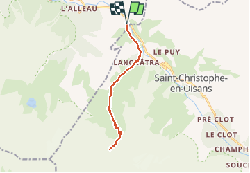

Length
14.6 km

Max alt
2195 m

Uphill gradient
1091 m
Km-Effort
29 km

Min alt
1170 m

Downhill gradient
1095 m
Boucle
Yes
Creation date :
2020-10-24 06:45:20.0
Updated on :
2020-10-26 18:05:14.283
7h09
Difficulty : Medium

FREE GPS app for hiking
 SityTrail
IGN / Geographical institutes
SityTrail Plus
The world is yours!
About
Trail Walking of 14.6 km to be discovered at Auvergne-Rhône-Alpes, Isère, Les Deux Alpes. This trail is proposed by c.gourme.
Description
Un passage aérien vers la fin
Positioning
Country:
France
Region :
Auvergne-Rhône-Alpes
Department/Province :
Isère
Municipality :
Les Deux Alpes
Location:
Vénosc
Start:(Dec)
Start:(UTM)
274895 ; 4984553 (32T) N.
Comments